Off The Ground utilizes cutting-edge drone photogrammetry technology to transform aerial images into highly accurate 3D models, point clouds, and orthomosaics. This powerful tool provides valuable data for a wide range of applications, from surveying and construction to mining and environmental monitoring.
How It Works:
Photogrammetry is the science of obtaining reliable measurements from photographs. By capturing numerous overlapping aerial images with a drone, specialized software processes these images to create detailed 3D representations of the surveyed area.
- Point Clouds: A dense set of data points in 3D space, representing the surface of the scanned object or area.
- 3D Models: Textured 3D representations of objects or terrain, suitable for visualization and analysis.
- Orthomosaics: Geometrically corrected aerial images with uniform scale, ideal for accurate measurements and mapping.
- Digital Elevation Models (DEMs/DSMs): Digital representations of terrain elevation, used for terrain analysis and modeling.
Key Benefits:
Accuracy and Precision:
- Achieve highly accurate measurements and 3D models with minimal error.
Efficiency and Speed:
- Capture large areas quickly and efficiently compared to traditional surveying methods.
Cost-Effectiveness:
- Reduce fieldwork time and labor costs while obtaining comprehensive data.
Safety:
- Minimize risks associated with traditional surveying in hazardous or difficult-to-access areas.
Detailed Data Capture:
- Capture a wealth of data, including elevation, texture, and color information.
Non-Invasive Data Collection:
- Collect data without disturbing the environment or requiring direct contact with the surveyed area.
What we offer:
1.
High-Resolution Imaging:
- We use advanced drones and high-resolution cameras to capture detailed images for accurate model creation.
2.
Precise Flight Planning:
- We develop custom flight plans to ensure optimal image overlap and data coverage.
3.
Professional Data Processing:
- Our experienced team uses specialized software to process the captured images and generate high-quality 3D models, point clouds, and orthomosaics.
4.
Customized Deliverables:
- We provide data in various formats to meet your specific needs and software compatibility.
5.
Data Analysis and Reporting (Optional):
- We can provide data analysis and reporting services to extract valuable insights from the generated data.
Where our services make a difference:
Surveying and Mapping:
- Creating accurate topographic maps, land surveys, and site plans.
Construction and Engineering:
- Monitoring construction progress, calculating earthwork volumes, and inspecting infrastructure.
Mining and Quarrying:
- Calculating stockpile volumes, monitoring mine progress, and assessing environmental impact.
Environmental Monitoring:
- Tracking changes in landscapes, vegetation, and coastlines.
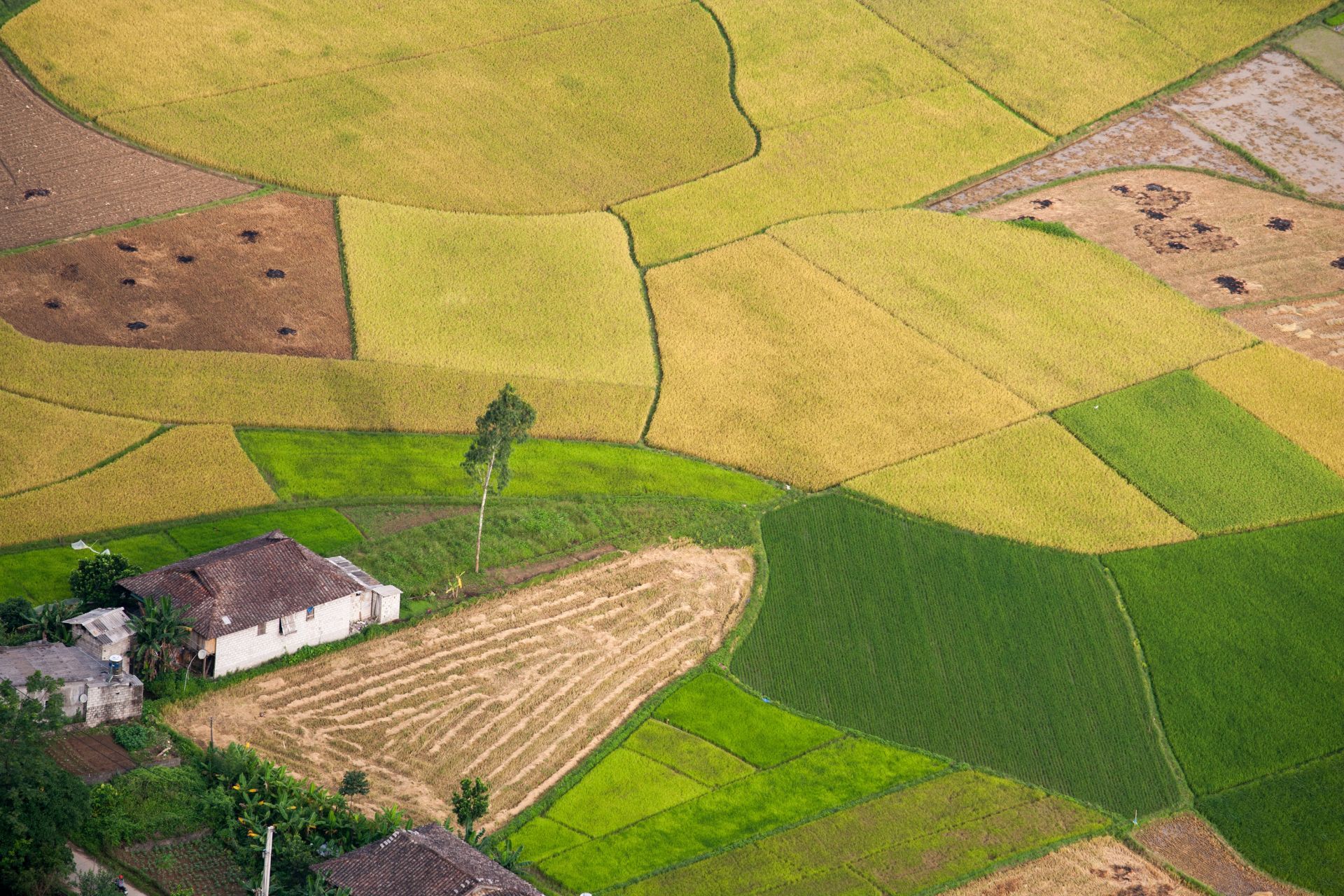
Agriculture and Precision Farming:
- Creating detailed terrain maps for precision agriculture and irrigation planning.
Archaeology and Cultural Heritage:
- Documenting archaeological sites and preserving cultural heritage.


What our clients say
FabuFit
“Amazing service. Can’t wait to use Off The Ground again.”
Ready to Transform Your Data?
Contact Off The Ground today to discuss your drone photogrammetry needs. We'll provide you with accurate and reliable data to support your projects.